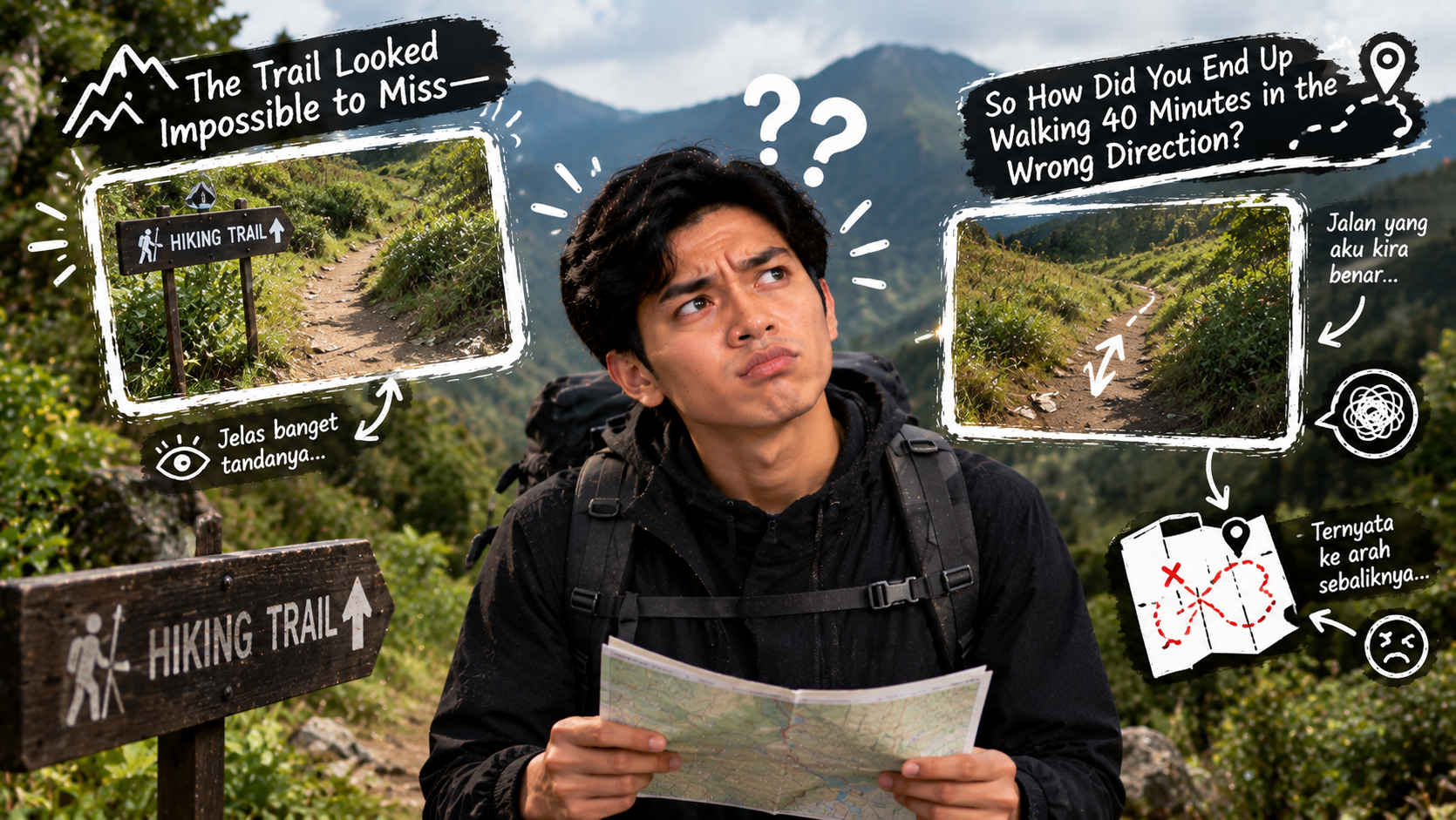
The trailhead looked simple.
There was one obvious path disappearing into the trees, a sign near the parking area, and enough footprints to make the route feel impossible to lose.
So you started walking.
No complicated map.
No real navigation plan.
Why would you need one?
For the first hour, everything seemed fine.
Then the trail divided.
One path looked slightly wider, so you followed it.
A little later, the terrain stopped looking familiar. There were fewer footprints. The trail became narrower. You could no longer remember when you last saw a marker.
You checked your phone.
The signal was gone.
Now the question was no longer whether you were still on the right trail.
It was how long you had been walking in the wrong direction.
This is why trail navigation matters even on hikes that appear straightforward. Navigation is not only a wilderness survival skill for people crossing remote mountains. It is the continuous process of knowing where you are, where you are going, and recognizing early when those two things stop matching.
The earlier you notice a navigation mistake, the easier it usually is to correct.
Navigation Starts Before You Reach the Trailhead
A common mistake is treating navigation as something you do only after becoming confused.
By then, the problem already exists.
Good navigation begins before the hike.
Look at the route.
Understand its approximate distance.
Check the elevation profile.
Identify major intersections.
Notice rivers, ridgelines, roads, lakes, shelters, viewpoints, or other obvious features.
Find out whether the hike is an out-and-back, loop, point-to-point route, or network of connected trails.
You do not need to memorize every turn.
You should simply have a mental picture of what the day is supposed to look like.
Know the Difference Between the Trail and the Route
These words sound interchangeable, but thinking about them separately is useful.
The trail is the physical path beneath your feet.
The route is the journey you intend to follow.
One trail can intersect several others.
A wide, obvious path may not be your route.
A narrow turn may be exactly where your route continues.
This distinction prevents one of the easiest navigation mistakes:
Assuming the most obvious path must be the correct one.
Sometimes it is.
Sometimes it leads somewhere completely different.
Download Your Map Before Leaving
Your phone may have excellent navigation tools.
That does not mean the mountain has excellent mobile coverage.
If you rely on a digital map, make sure the relevant area is available offline before the hike.
Do this somewhere with reliable internet.
Then verify that it actually works without a connection.
Downloading an app is not the same as downloading the map data.
Discovering that difference after losing signal is not useful.
A Screenshot Is Better Than Nothing—But Limited
Taking a screenshot of the route can provide a useful backup reference.
You can see intersections.
You can remember the general shape of the trail.
But a screenshot usually cannot provide all the functionality of a proper offline map.
It may not show your live location.
Zooming can reduce detail.
Nearby trails outside the captured area may be missing.
Use screenshots as supplementary information rather than assuming one image replaces a navigation system.
Your Phone Battery Is Part of the Navigation System
If your only map exists on your phone, battery percentage suddenly becomes a safety consideration.
Navigation apps, GPS use, photography, cold temperatures, screen brightness, and poor signal conditions can all affect battery life.
Start with a charged device.
Consider carrying a suitable power bank for longer or more remote hikes.
Reduce unnecessary battery use.
And avoid spending half the hike scrolling through unrelated apps if the same phone is your primary navigation tool.
A digital map is useful only while the device can display it.
Paper Maps Still Have a Purpose
A paper map does not need a cellular signal.
It does not run out of battery.
It can show a large area at once.
For more remote trips, those advantages matter.
But simply carrying a map does not automatically make it useful.
Learn how to interpret it.
Understand the legend.
Recognize trails, roads, water, contour lines, and major landmarks.
Know approximately where your route sits on the map.
A folded piece of paper at the bottom of your backpack is not much of a backup if you have never looked at it.
A Compass Is Most Useful When You Know How to Use It
Buying a compass the night before a remote hike does not instantly create navigation skills.
Learn the basics in a low-risk environment.
Understand direction.
Learn how the compass relates to a map.
Practice orienting yourself.
Try following simple bearings where getting something wrong does not create danger.
Navigation skills become useful through practice, not ownership.
The same applies to GPS devices and navigation apps.
Equipment is only part of the system.
Pay Attention While You Are Still Confident
This is one of the easiest ways to improve trail navigation.
Do not wait until you are lost to start observing your surroundings.
Notice intersections.
Trail signs.
Bridges.
Streams.
Large bends.
Distinctive rocks.
Open meadows.
Changes in vegetation.
Steep climbs and descents.
Every recognizable feature helps maintain your mental position.
Think of navigation as a continuous conversation between the map and the landscape.
Check Your Position at Important Intersections
You reach a junction.
One path goes left.
One continues straight.
The straight path looks more established.
This is exactly when to check.
Not fifteen minutes later.
Pause.
Look at the map.
Read signs if available.
Compare the direction of each trail.
Confirm which one matches your route.
Thirty seconds spent checking at the intersection can save an hour of backtracking.
Do Not Follow Other Hikers Blindly
The group ahead looks confident.
They have expensive backpacks.
One person is holding trekking poles.
Surely they know where they are going.
Maybe.
Or maybe they are hiking a completely different route.
They might be heading toward another campsite, viewpoint, climbing area, or trailhead.
They might also be lost.
Other hikers can provide useful information, but their presence is not proof that you are on your intended route.
Navigate independently.
Footprints Are Not Trail Markers
A path has many footprints.
That can feel reassuring.
But footprints tell you only that other people walked there.
They do not tell you where those people were going.
Side trails may lead to campsites.
Water sources.
Fishing spots.
Viewpoints.
Shortcuts.
Rest areas.
Old routes.
Some unofficial paths become surprisingly well worn.
Use actual navigation information rather than treating popularity as direction.
Learn How the Trail Is Marked
Trail marking systems vary.
You might encounter painted blazes, signs, posts, cairns, ribbons, or other markers depending on the location and management system.
Before relying on them, understand what is officially used on that trail.
Do not assume every pile of rocks is a navigation marker.
Do not add your own markings.
And do not depend entirely on markers remaining visible.
Weather, vegetation, damage, maintenance, or vandalism can affect them.
Markers should support your navigation, not replace it.
Look Back After Important Turns
This simple habit is surprisingly valuable.
You reach an intersection and turn right.
After taking the turn, look behind you.
What does the intersection look like from the opposite direction?
The return journey may look completely different.
A side path that was obvious on the way out might be nearly invisible when approaching from the other side.
Taking a few seconds to look backward creates a visual memory for later.
Take Photos of Complicated Junctions
If an intersection seems confusing, photograph it.
Include the sign if there is one.
Capture the direction you arrived from.
This can provide a quick visual reference on the return trip.
You are not replacing your map.
You are creating additional information.
Photos can also help when explaining your location to others if something goes wrong.
Distance Is Easy to Misjudge
“This feels like we’ve walked about two miles.”
Maybe.
Human estimates of distance can be surprisingly unreliable, especially when terrain changes.
A steep mile feels different from a flat mile.
Technical terrain changes pace.
Heat changes pace.
Fatigue changes pace.
Frequent stops change pace.
Instead of relying entirely on how far you feel you have walked, compare time, distance, landmarks, and map position.
Time Can Be a Navigation Clue
Suppose your route description indicates a major junction approximately an hour into the hike.
Two hours later, you still have not seen it.
That should trigger a check.
Maybe your pace is unusually slow.
Maybe the estimate was optimistic.
Or maybe you passed the junction.
Expected timing should never be treated as exact, but large discrepancies can signal that something deserves attention.
Elevation Can Tell You a Lot
A route climbs steadily toward a ridge.
But for the last twenty minutes, you have been descending.
That is information.
Perhaps the route includes a temporary descent.
Or perhaps you took the wrong trail.
Understanding the basic elevation profile gives you another way to compare expectations with reality.
You do not need to constantly stare at an altimeter.
Just know whether the major sections should generally be going up, down, or remaining relatively level.
Contour Lines Tell the Shape of the Land
On a topographic map, contour lines represent elevation.
Closely spaced lines generally indicate steeper terrain.
Wider spacing indicates gentler slopes.
Patterns can reveal ridges, valleys, saddles, and other terrain features.
Learning to connect those lines with the actual landscape is one of the most useful navigation skills.
A map stops looking like abstract markings.
It begins describing the terrain around you.
Use Large Features to Maintain Orientation
Tiny trail details are easy to miss.
Large terrain features are harder to ignore.
A river.
Ridgeline.
Lake.
Road.
Coastline.
Large valley.
Prominent summit.
If you know where these features sit relative to your route, they can help maintain general orientation.
For example, knowing that a river should remain on one side of the trail can provide useful context.
If it suddenly appears on the opposite side without an expected crossing, something may deserve investigation.
But Do Not Force the Landscape to Match Your Expectations
This is a dangerous mental habit.
You believe you are on the correct trail.
So every feature gets interpreted to support that belief.
“That must be the ridge.”
“This stream probably isn’t shown on the map.”
“The trail probably changed.”
“The junction must be farther ahead.”
Sometimes those explanations are true.
But repeated mismatches should reduce your confidence.
Do not keep bending reality to fit your assumption.
Stop and verify.
The Earlier You Admit You Might Be Wrong, the Better
Navigation mistakes become larger because people hesitate to acknowledge them.
You have already walked fifteen minutes.
Turning around feels annoying.
So you continue for another fifteen.
Now turning around feels even more annoying.
Soon you are forty-five minutes from the last confirmed location.
This is essentially a navigation version of sunk-cost thinking.
Distance already walked is not a reason to continue in the wrong direction.
Establish Your Last Known Point
When something feels wrong, ask:
Where was the last place I was definitely on the correct route?
Maybe it was a signed intersection.
A bridge.
A viewpoint.
A campsite.
A distinctive turn.
That is your last known point.
If you can safely return to it, you can reset the navigation problem from a location you understand.
This is usually much better than wandering forward hoping the trail eventually becomes familiar.
Stop Before Confusion Becomes Panic
You realize you may be off route.
Your instinct might be to move faster.
Do the opposite.
Stop.
Think.
Look at the map.
Check your location if your navigation device can provide it.
Observe the terrain.
Consider the last confirmed point.
Rushing while uncertain can increase the distance between you and the correct route.
Confusion is a reason for more deliberate decisions, not faster movement.
Do Not Create Your Own Shortcut Through Unknown Terrain
The map shows the correct trail only a short distance away.
Why not cut directly through the trees?
Because map distance does not reveal every hazard.
That short line could cross:
Dense vegetation.
Cliffs.
Loose slopes.
Private property.
Deep water.
Unstable terrain.
A drainage channel.
Terrain that takes far longer to cross than expected.
Unless you have the skills and information to travel safely off-trail, returning along the known path is generally the more predictable option.
Shortcuts Can Turn a Navigation Error Into a Terrain Problem
Being on the wrong trail is one problem.
Leaving that trail creates another.
Now you may have no clear path to follow back.
Instead of solving one known error, you introduce uncertainty about terrain, direction, and your exact location.
The shortest geometric line is not always the safest route.
Trails exist for a reason.
Trail Apps Are Excellent—Until You Use Them Passively
A navigation app can show exactly where you are relative to a route.
That is incredibly useful.
But there is a downside if you stop observing the landscape completely.
You become dependent on the blue dot.
Battery dies?
Problem.
Device breaks?
Problem.
Map fails to load?
Problem.
Use digital navigation actively.
Look at the app.
Then look around.
Connect the digital information with physical features.
Technology should strengthen situational awareness rather than replace it.
GPS Accuracy Is Not Perfect
A location marker on your phone can feel absolute.
It is not.
Accuracy can vary depending on terrain, device, satellite visibility, and other conditions.
In deep valleys, dense forests, or near steep terrain, location information may be less precise.
This matters when trails run close together or when you are trying to identify a subtle intersection.
Treat GPS as powerful information, but compare it with the landscape and map.
Do Not Wait Until the Battery Is at 3%
If your phone is the main navigation tool, manage battery proactively.
Use airplane mode where appropriate if you do not need connectivity.
Reduce unnecessary screen use.
Keep the device protected from extreme cold.
Carry backup power when the trip warrants it.
And know enough about the route that losing the device would not instantly erase every piece of navigation information you have.
Redundancy becomes more important as remoteness increases.
Weather Can Make an Easy Trail Hard to Follow
A trail that is obvious under clear skies may become difficult in fog.
Snow can hide the path.
Heavy rain can obscure tracks.
Low cloud can remove distant landmarks.
Wind can damage signs or vegetation.
Darkness changes everything again.
Navigation difficulty is therefore not fixed.
The same trail can demand completely different skills depending on conditions.
Check the forecast and consider how weather could affect visibility.
Darkness Changes Familiar Terrain
A trail that seemed unmistakable during daylight can look surprisingly confusing after sunset.
Landmarks disappear.
Depth perception changes.
Small intersections become harder to notice.
If there is any chance the hike could continue into darkness, carry a proper light source.
Do not rely solely on a phone flashlight.
A headlamp keeps your hands free and is designed for exactly this type of situation.
Turnaround Time Is a Navigation Tool Too
Navigation is not only about direction.
It is also about time management.
Decide when you need to turn around to return safely.
If reaching the destination takes much longer than expected, continuing may leave insufficient daylight.
The summit, waterfall, or viewpoint will still exist another day.
A turnaround time prevents the destination from becoming more important than the return journey.
The Destination Is Only Half the Route
Reaching the summit feels like success.
But unless transportation is waiting there, the hike is not finished.
You still need to return.
Navigation planning should include the entire trip.
Distance back.
Elevation changes.
Daylight.
Water.
Weather.
Fatigue.
A route that feels manageable on the way out can feel very different when legs are tired and concentration has decreased.
Fatigue Makes Navigation Worse
As people become tired, attention can narrow.
You stop checking the map.
You follow whoever is ahead.
You miss signs.
You become more eager to choose the path that looks easiest.
This makes the final portion of a long hike especially important.
Continue navigating even when the trailhead feels close.
Do not mentally finish the hike before physically reaching the end.
Groups Can Still Get Lost
More people do not automatically create better navigation.
Sometimes groups create false confidence.
Everyone assumes someone else knows the route.
One person walks ahead.
Others follow.
Nobody checks.
Then the entire group discovers that nobody actually confirmed the last intersection.
Make navigation responsibility explicit.
At least one person should actively monitor the route, and ideally more than one person should understand the plan.
Do Not Let the Fastest Hiker Make Every Navigation Decision
The person at the front reaches intersections first.
If they immediately choose a direction, everyone else may follow without checking.
That can turn pace into authority.
Instead, regroup at significant junctions.
Confirm the route.
Then continue.
A thirty-second pause is cheaper than making the entire group backtrack.
Tell Someone Your Plan Before Remote Hikes
For more remote trips, leave your route information with someone who is not on the hike.
Include where you are going.
Expected route.
Trailhead.
Approximate return time.
And when they should become concerned if you have not checked in.
If plans change substantially, update them when possible.
This does not prevent navigation mistakes.
It creates another layer of safety if something goes seriously wrong.
Route Sharing Is Not a Substitute for Preparation
Sending a route to a friend is useful.
It does not mean you can stop understanding the route yourself.
Likewise, carrying a satellite communication device does not make navigation irrelevant.
Emergency equipment helps when a problem has already developed.
Navigation aims to prevent a small directional mistake from becoming that emergency.
Both have value.
They solve different parts of the risk.
Practice Navigation on Easy Trails
Do not make your first serious map-and-compass experience a remote wilderness trip.
Practice somewhere forgiving.
Choose a familiar local trail.
Follow your position on a map.
Predict the next intersection before reaching it.
Compare terrain with contour lines.
Estimate how far you have walked.
Use a compass.
Then verify yourself with GPS.
Low-risk practice builds skills you can use when technology becomes unavailable or conditions become more difficult.
Try Predicting What Comes Next
This is one of the best exercises.
Look at your map.
You see that the trail should climb for a while, cross a small stream, then turn sharply near an intersection.
Put the map away.
Walk.
Can you recognize those features as they appear?
When you can predict the landscape before reaching it, you are navigating actively.
You are no longer just checking whether a line on a screen matches your position.
Learn the Route in Sections
A long route can feel complicated when viewed as one continuous journey.
Break it into sections.
Trailhead to first junction.
Junction to stream crossing.
Stream to ridge.
Ridge to summit.
Summit back to junction.
This gives you manageable checkpoints.
At each one, confirm that the hike is progressing as expected.
If a checkpoint never appears, investigate before continuing far beyond where it should have been.
Navigation Is Really About Managing Uncertainty
You will rarely know everything perfectly.
Signs may be missing.
Distances may differ slightly.
GPS may drift.
Trails may have been rerouted.
Weather may hide landmarks.
The goal is not absolute certainty every second.
The goal is recognizing when uncertainty becomes too high.
If three pieces of information agree, confidence increases.
If everything begins contradicting your expectations, confidence should decrease.
Good navigators adjust their decisions based on that confidence.
Confidence and Competence Are Not the Same
Someone can confidently walk in the wrong direction.
That is what makes navigation mistakes deceptive.
The trail feels right.
Everyone agrees.
The scenery seems plausible.
No alarm sounds when you make the wrong turn.
So build habits that verify your confidence.
Check intersections.
Confirm landmarks.
Monitor direction.
Compare expected and actual progress.
Verification protects you from being confidently wrong.
Conclusion
The easiest trail to get lost on is sometimes the one you were convinced you could not possibly lose.
Good trail navigation does not mean staring at a map for the entire hike or carrying complicated equipment you do not understand.
It means maintaining awareness.
Know the basic route before leaving. Download maps before losing connectivity. Keep your navigation device charged. Understand major intersections and landmarks. Pay attention to terrain while everything still makes sense.
Most importantly, verify early when something feels wrong.
Do not keep walking simply because turning around is inconvenient.
Identify your last known point.
Compare the landscape with your map.
Return along a known route when that is the safer option rather than inventing an uncertain shortcut.
Navigation mistakes are often small at the beginning.
One missed junction.
One incorrect assumption.
One decision to keep walking for another ten minutes.
The goal is to catch that small mistake while it is still only a small mistake.
Because on the trail, knowing how to reach the destination matters.
Knowing when you are no longer heading toward it matters even more.